|
First Century Corinth |
||
|
The landmarks are still there. |
||
This page may only be used in schools and churches for non-profitable and educational purposes.
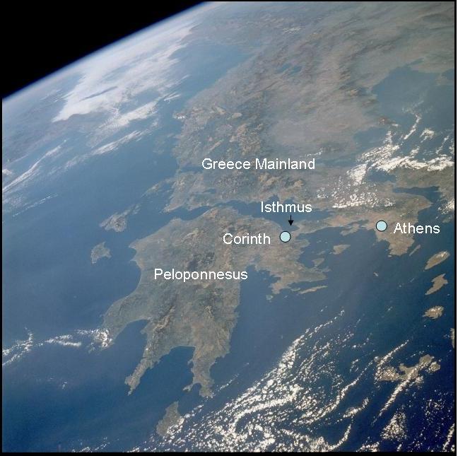
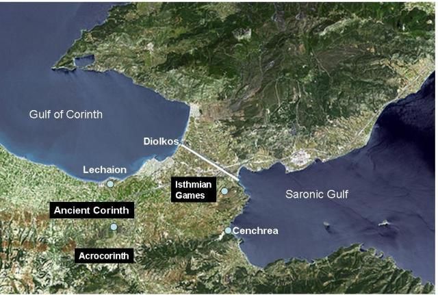
In the first century, forty-eight miles west of Athens, Corinth guarded a land-bridge (isthmus) between two gulfs. (NASA photos, above and below, are in public domain. Markers and names inserted by author).
The Gulf of Corinth stretched to the west and the Saronic Gulf to the east of the isthmus joining the Peloponnesus to mainland Greece, determining Corinth’s lucrative socio-economic activities. Thanks to its strategic location, Corinth prospered at AD 50 from both east-west sea trade and north-south land trade. The sea route around the Peloponnesus peninsula was hazardous. Most seafarers chose to unload their cargo at Cenchrea or Lechaion (Corinth’s east and west harbors named after the sons of Poseidon), transport the goods by wagon from one harbor to the other eight miles away, and load it on another ship to proceed to the destination.
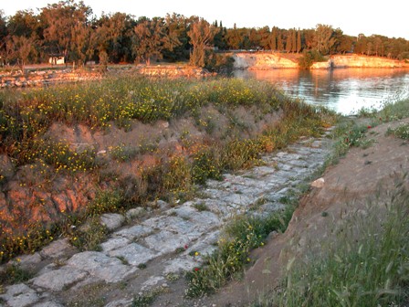
After unloading their cargo, smaller ships were hauled by trolley over the four mile wide isthmus, using the Diolkos, a narrow stone-paved road. (Picture from CD Pictorial Library of Bible Lands). The Channel of Corinth was completed in 1893. The highest point is about 260 ft above sea level. It shows the arduous uphill and downhill trek boats had to complete when hauled over the Diolkos. Picture by author. By day, Corinth and its harbors were busy ant-nests of transport activity. By night, the city's entertainment industry came to life. Sadly, Corinth’s hard work and good money spawned indulgence and excess. Taverns and brothels increased and flourished. The city’s immoral ways became proverbial. Even in other parts of the Roman Empire a person with a wild life-style was labeled a "Corinthian." Paul warned the Corinthians in his letters against sexual immorality (1 Cor. 5). The mere fact that many Corinthians did accept the gospel and did change their life-style is nothing short of a miracle (Acts 18:10). Wagons loaded with merchandise from the East Mediterranean moved from Cenchrea westward to Corinth. Having paid the toll, they proceeded north to Lechaion on the Gulf of Corinth. Another stream of wagons with cargo coming from the West Mediterranean moved the opposite way. The location of city and harbors formed a triangle (see NASA photos above).
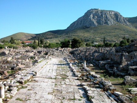
The two mile long Lechaion Road was paved with flat stones and protected by stone walls on either side (Picture from CD Pictorial Library of Bible Lands). In the city, this street ended at steps and an arched entrance leading to the agora. In the spring of every third year, the year before and after the Olympics, Corinth hosted the Isthmian Games on the isthmus, honoring the sea-god Poseidon for bringing the trade ships to Corinth. The terrain of the Isthmian Games was south-east of the Diolkos, near the temple of Poseidon. This event was popular with the Athenians too, as this locality was closer to them than any of the other major Greek athletic events. Even more important—they could come in great numbers by boat, eliminating an arduous journey by foot or horse carriage. What better way to honor Poseidon than to come by sea! They were brought by wagons from Cenchrea to the Games. After the sacrifice at the temple, people streamed to the stadium to the east of the temple. The old stadium started at the temple, its far end meeting the new stadium in a T-formation.
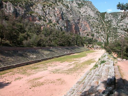
The well preserved Delphi stadium (Picture from CD Pictorial Library of Bible Lands) shows the layout of Greek stadia. The 600 foot running course of Corinth's new stadium was also flanked by seat-covered embankments on each side of the running track. The length of a stadium became the unit to measure long distances. Paul referred to athletes in his letters to the Corinthians (1 Cor. 9:24-27). Before the destruction of Corinth by the Romans in 146 BC the Aphrodite temple on Acrocorinth (the mountain south of the old city) was served by thousand temple prostitutes trying to convince the goddess of love to send rain on time. When Julius Caesar ordered the restoration of Corinth a century later, the ruined Aphrodite temple was not included in the project. The remains of the Apollo temple is in the foreground of the picture taken by the author. The apostle Paul reached this sinful city with the gospel about AD 51 (Acts 18). He planted a church and ministered to them for eighteen months. Afterwards, he visited them twice and wrote to them four letters, of which two survived. When Gallio was proconsul (judge) in Corinth the Jews dragged Paul to the Bema and accused him of inciting unrest. The Bema was an eight foot high platform in the agora and is shown here in the foreground of the picture taken by the author. In 2 Cor. 5:10 Paul refers to the Bema of Christ―the Corinthians would have understood. On the agora (city square), just opposite the Bema, are the remains of shops, with the Apollo temple in the background in picture taken by the author.
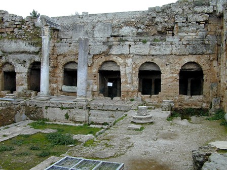
According to a myth, Peirene shed so many tears over the accidental death of her son Cenchreas that her tears turned into this fountain, a source of comfort for the grieving and thirsty. (Picture from CD Pictorial Library of Bible Lands). Greek mythology was memorialized by the names of temples, fountains, and harbors.
A novel
THE
BROKEN SPEAR
Now Available
NASA composite photo of the River Nile
**********
|
